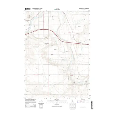
2013 Map of Pasadena Valley
USGS Topo · Published 2013About this map
The Snake River carves through this high desert landscape, defining the borders between the uplands of Black Mesa and the lower fertile stretches of Pasadena Valley. In the early 21st century, the intricate irrigation network remains central to the region's character, with features like the King Hill-Main Canal, Y Canal, and Basin Lateral snaking across the terrain to support local agriculture. Small settlements and geographic landmarks such as Frog Hollow and Swiss Valley sit alongside family-named landmarks like Jolley Flat and The Pasture, reflecting a deep connection between the land and its inhabitants. Geologists and local historians can trace the numerous drainages feeding the river, from Rosevear Gulch to Big Pilgrim Gulch, and identify natural water sources like Bancroft Springs and Pilgrim Spring. The map also details a network of rural routes, including the King Hill Loop and Bell Rapids Rd, which connect these isolated valleys and plateaus.
Find a feature on this map
50 named features on this map. Tap any name to fly to it.
Don’t see what you’re looking for? This feature index may not catch every label — zoom into the map to look around manually.
Map Details
Editions of this 2013 Pasadena Valley Map
This is the sole edition of this map. No revisions or reprints were ever made.
Other maps of this area

1892 · Camas Prairie
USGS Topo · 1:125,000

1893 · Camas Prairie
USGS Topo · 1:125,000

1947 · Glenns Ferry
USGS Topo · 1:24,000

1947 · Pasadena Valley
USGS Topo · 1:24,000

1948 · Pasadena Valley
USGS Topo · 1:24,000

1948 · Glenns Ferry
USGS Topo · 1:24,000

1948 · Twentymile Butte
USGS Topo · 1:24,000

1948 · Glenns Ferry
USGS Topo · 1:62,500

1948 · Ticeska
USGS Topo · 1:24,000

1948 · Grindstone Butte
USGS Topo · 1:24,000