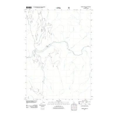
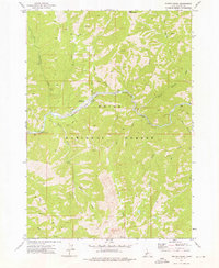
2011 Map of Phifer Creek
USGS Topo · Published 2011About this map
The Middle Fork Boise River serves as the central drainage for this section of Idaho’s interior, where the Middle Fork Rd provides the primary access route through a network of steep canyons and creek beds. This landscape is defined by its drainage basins, including the extensive Phifer Creek system and the Black Warrior Creek drainage. A notable point of human activity in this isolated terrain is the Weatherby-US Forest Service Airport, located near the confluence of Fly Creek and the main river. Smaller tributaries like Steel Creek, Lake Creek, and Swanholm Creek branch out from the river valley, illustrating the complex hydrology of the Boise River basin. The map captures a moment in the early 21st century when these remote Forest Service lands remained focused on waterway management and limited aviation access.
Find a feature on this map
18 named features on this map. Tap any name to fly to it.
Don’t see what you’re looking for? This feature index may not catch every label — zoom into the map to look around manually.
Map Details
Editions of this 2011 Phifer Creek Map
This is the sole edition of this map. No revisions or reprints were ever made.
Other maps of this area

1894 · Rocky Bar
USGS Topo · 1:125,000

1955 · Hailey
USGS Topo · 1:250,000

1959 · Hailey
USGS Topo · 1:250,000

1962 · Hailey
USGS Topo · 1:250,000

1964 · Little Trinity Lake
USGS Topo · 1:24,000

1964 · Cayuse Point
USGS Topo · 1:24,000
1964 · Rocky Bar
USGS Topo · 1:24,000
1972 · Bear River
USGS Topo · 1:24,000
1972 · Swanholm Peak
USGS Topo · 1:24,000
1972 · Phifer Creek
USGS Topo · 1:24,000