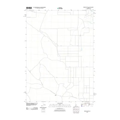
2010 Map of Indian Butte
USGS Topo · Published 2010About this map
Indian Butte rises above the high desert floor of southern Idaho, serving as a central landmark for this agricultural and transport corridor. The landscape is defined by its water infrastructure, notably the Tuana Canal and Cassia Canal which facilitate farming in this arid region, while Tuana Spring provides a natural water source in the northeast. The presence of the Old Oregon Trail Hwy at the northern edge of the map underscores the area's deep historical significance as a primary path for westward migration. Local movement is dictated by a grid of rural roads and the diagonal Glenns Ferry Castleford Rd, reflecting the modern ranching and farming operations that continue to shape the terrain in this part of Twin Falls County.
Find a feature on this map
12 named features on this map. Tap any name to fly to it.
Don’t see what you’re looking for? This feature index may not catch every label — zoom into the map to look around manually.
Map Details
Editions of this 2010 Indian Butte Map
This is the sole edition of this map. No revisions or reprints were ever made.
Other maps of this area

1947 · Pasadena Valley
USGS Topo · 1:24,000

1948 · Pasadena Valley
USGS Topo · 1:24,000

1948 · Twentymile Butte
USGS Topo · 1:24,000

1948 · Ticeska
USGS Topo · 1:24,000

1949 · Ticeska
USGS Topo · 1:24,000

1949 · Pasadena Valley
USGS Topo · 1:62,500

1949 · Bliss
USGS Topo · 1:24,000

1949 · Hagerman
USGS Topo · 1:24,000

1949 · Indian Butte
USGS Topo · 1:24,000

1950 · Hagerman
USGS Topo · 1:24,000