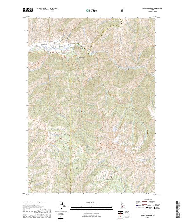
2023 Map of Jumbo Mountain
USGS Topo · Published 2023About this map
The Sawtooth National Forest dominates this high-elevation landscape where the South Fork Boise River carves through the northern reaches of the quadrangle. The terrain is a complex network of steep drainages, including Big Water Gulch and Weeks Gulch, which feed the river system. Settlement is sparse, represented primarily by the Deer Park area near the center of the sheet and the South Fork Ranch Airport in the northwest corner. The map documents an extensive system of wilderness travel routes, such as the Skeleton Creek Trl and the Iron Mountain Trl, which provide access to peaks like Jumbo Mtn and Iron Mountain. These trails follow the natural contours of the Soldier Mountains and Sawtooth Mountains, tracing the historical pathways used by forest rangers and backcountry travelers before modern road development was established.
Find a feature on this map
58 named features on this map. Tap any name to fly to it.
Don’t see what you’re looking for? This feature index may not catch every label — zoom into the map to look around manually.
Map Details
Editions of this 2023 Jumbo Mountain Map
This is the sole edition of this map. No revisions or reprints were ever made.
Other maps of this area

1892 · Camas Prairie
USGS Topo · 1:125,000

1893 · Camas Prairie
USGS Topo · 1:125,000

1894 · Rocky Bar
USGS Topo · 1:125,000

1900 · Sawtooth
USGS Topo · 1:125,000

1955 · Hailey
USGS Topo · 1:250,000

1957 · Fairfield
USGS Topo · 1:62,500

1959 · Hailey
USGS Topo · 1:250,000

1962 · Hailey
USGS Topo · 1:250,000

1963 · Deer Mountain
USGS Topo · 1:24,000
1963 · Sprout Mtn
USGS Topo · 1:24,000