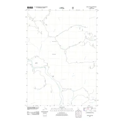
2011 Map of Long Gulch
USGS Topo · Published 2011About this map
The South Fork Boise River carves a deep path through this section of Elmore County, defining the drainage patterns for numerous tributaries including Big Fiddler Creek and Wood-Cabin Creek. High points like Krall Mountain and Flatiron Mountain overlook a landscape shaped by forest management and recreation. The presence of the Elk Creek Exclosure suggests focused wildlife or botanical study area near the headwaters of Elk Creek. Access to the backcountry is provided by a network of forest routes, most notably Blacks Creek Rd and Slide Gulch Rd, which lead travelers toward the Rattlesnake Campground and the namesake settlement of Long Gulch situated along the river's bend.
Find a feature on this map
27 named features on this map. Tap any name to fly to it.
Don’t see what you’re looking for? This feature index may not catch every label — zoom into the map to look around manually.
Map Details
Editions of this 2011 Long Gulch Map
This is the sole edition of this map. No revisions or reprints were ever made.
Other maps of this area

1892 · Mountain Home
USGS Topo · 1:125,000

1893 · Mountain Home
USGS Topo · 1:125,000

1894 · Idaho Basin
USGS Topo · 1:125,000

1955 · Hailey
USGS Topo · 1:250,000

1959 · Hailey
USGS Topo · 1:250,000

1960 · Mayfield
USGS Topo · 1:62,500

1960 · Danskin Peak
USGS Topo · 1:62,500

1962 · Hailey
USGS Topo · 1:250,000
1964 · Prairie
USGS Topo · 1:24,000

1964 · Sheep Creek
USGS Topo · 1:24,000