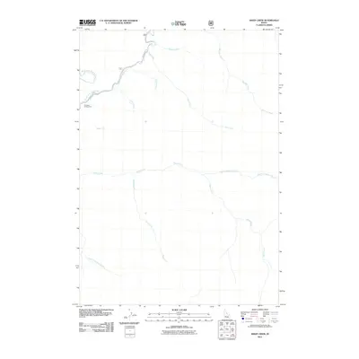
2011 Map of Sheep Creek
USGS Topo · Published 2011About this map
The Middle Fork Boise River and its confluence with the North Fork Boise River define the northwestern corner of this mountain landscape. In the early 21st century, this area remains primarily defined by its drainage systems, including the long southern course of Devils Creek and the western flow of Sheep Creek. Human footprint is minimal, represented by the Troutdale Campground and the gravel track of the Middle Fork Rd which follows the river's bend.
Find a feature on this map
14 named features on this map. Tap any name to fly to it.
Don’t see what you’re looking for? This feature index may not catch every label — zoom into the map to look around manually.
Map Details
Editions of this 2011 Sheep Creek Map
This is the sole edition of this map. No revisions or reprints were ever made.
Other maps of this area

1894 · Idaho Basin
USGS Topo · 1:125,000

1894 · Rocky Bar
USGS Topo · 1:125,000

1955 · Hailey
USGS Topo · 1:250,000

1959 · Hailey
USGS Topo · 1:250,000

1962 · Hailey
USGS Topo · 1:250,000
1964 · Prairie
USGS Topo · 1:24,000
1964 · Trinity Mtn
USGS Topo · 1:24,000

1964 · Little Trinity Lake
USGS Topo · 1:24,000

1964 · Sheep Creek
USGS Topo · 1:24,000

1964 · Twin Springs
USGS Topo · 1:24,000