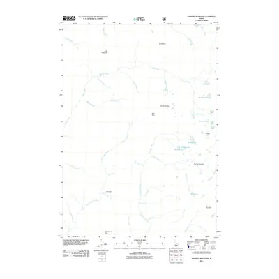
2011 Map of Nahneke Mountain
USGS Topo · Published 2011About this map
Overlook Mill sits at the headwaters of Overlook Creek, representing the industrial history of this high-elevation landscape in Elmore County. The area is defined by a dense concentration of alpine water bodies, including Azure Lake, Rock Island Lake, and the clustered Diamond Lake and Triangle Lake. These basins feed into a complex drainage system led by the Little Queens River and Black Warrior Creek, which carve through the terrain between prominent summits like Nahneke Mountain and Big Buck Mountain. This 2011 survey documents the established names of the Sawtooth range peaks and the specific geography of High Pass, offering a precise record of the backcountry before recent shifts in forest management and naming conventions.
Find a feature on this map
41 named features on this map. Tap any name to fly to it.
Don’t see what you’re looking for? This feature index may not catch every label — zoom into the map to look around manually.
Map Details
Editions of this 2011 Nahneke Mountain Map
This is the sole edition of this map. No revisions or reprints were ever made.
Other maps of this area

1891 · Bear Valley
USGS Topo · 1:125,000

1893 · Bear Valley
USGS Topo · 1:125,000

1894 · Rocky Bar
USGS Topo · 1:125,000

1955 · Hailey
USGS Topo · 1:250,000

1957 · Challis
USGS Topo · 1:250,000

1959 · Hailey
USGS Topo · 1:250,000

1960 · Challis
USGS Topo · 1:250,000

1962 · Hailey
USGS Topo · 1:250,000

1963 · Challis
USGS Topo · 1:250,000
1972 · Atlanta East
USGS Topo · 1:24,000