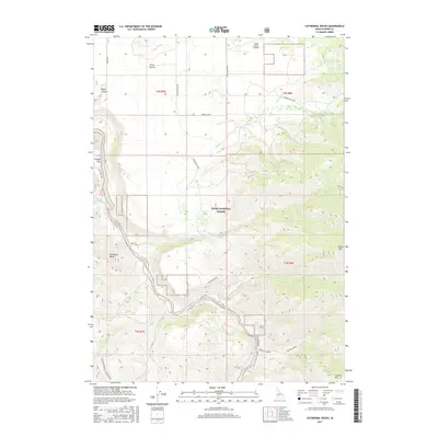
2017 Map of Cathedral Rocks
USGS Topo · Published 2017About this map
Smith Prairie and the deep incision of the South Fork Boise River dominate this portion of the Boise National Forest in Elmore County. The landscape is defined by the sharp contrast between the level heights of the prairie, served by the Smith Prairie Airport, and the steep, complex drainage systems of Rock Cr and Granite Creek. Early water management is evident along the northern plateau via the Pierce Ditch, while the namesake Cathedral Rocks rise above the river canyon to the southwest. This area preserves a network of primitive forest roads and spurs, such as Prairie-Pine Road and the Prairie Cutoff, which provide access to high points like House Mtn and the southern Danskin Ridge. The map documents the remote terrain where seasonal creeks like Dead Horse Cr and Menneke Cr feed into the regional river system.
Find a feature on this map
39 named features on this map. Tap any name to fly to it.
Don’t see what you’re looking for? This feature index may not catch every label — zoom into the map to look around manually.
Map Details
Editions of this 2017 Cathedral Rocks Map
This is the sole edition of this map. No revisions or reprints were ever made.
Other maps of this area

1892 · Mountain Home
USGS Topo · 1:125,000

1892 · Camas Prairie
USGS Topo · 1:125,000

1893 · Mountain Home
USGS Topo · 1:125,000

1893 · Camas Prairie
USGS Topo · 1:125,000

1894 · Idaho Basin
USGS Topo · 1:125,000

1894 · Rocky Bar
USGS Topo · 1:125,000

1955 · Hailey
USGS Topo · 1:250,000

1959 · Hailey
USGS Topo · 1:250,000

1960 · Danskin Peak
USGS Topo · 1:62,500

1962 · Hailey
USGS Topo · 1:250,000