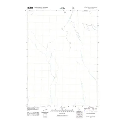
2011 Map of Bennett Mountain
USGS Topo · Published 2011About this map
Bennett Mountain stands as the primary geographic focal point in this high-altitude landscape of Elmore County. The terrain is defined by a complex network of seasonal drainage and perennial streams that descend from the mountain's flanks, including the prominent Bennett Creek and the meandering West Fork Cold Springs Creek. This 2011 survey illustrates a region shaped by natural watercourses rather than urban development, highlighting the significance of landmarks like Ryegrass Creek and Thorn Creek for local navigation. The lack of named settlements emphasizes the area's use for grazing or resource management, where specific water sources such as Hot Springs Creek and Willow Creek serve as the principal named identifiers for land tracts and access points.
Find a feature on this map
9 named features on this map. Tap any name to fly to it.
Don’t see what you’re looking for? This feature index may not catch every label — zoom into the map to look around manually.
Map Details
Editions of this 2011 Bennett Mountain Map
This is the sole edition of this map. No revisions or reprints were ever made.
Other maps of this area

1892 · Mountain Home
USGS Topo · 1:125,000

1892 · Camas Prairie
USGS Topo · 1:125,000

1893 · Mountain Home
USGS Topo · 1:125,000

1893 · Camas Prairie
USGS Topo · 1:125,000

1955 · Hailey
USGS Topo · 1:250,000
1956 · Reverse
USGS Topo · 1:24,000

1956 · Mountain Home
USGS Topo · 1:62,500
1958 · Bennett Mtn
USGS Topo · 1:62,500

1959 · Hailey
USGS Topo · 1:250,000

1960 · Danskin Peak
USGS Topo · 1:62,500