
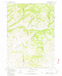
1963 Map of Deer Mountain
USGS Topo · Published 1964About this map
Deer Mountain stands as the prominent landmark in this drainage basin of the Sawtooth National Forest and Game Preserve, where the headwaters of the Lime Creek system dominate the landscape. The intricate network of seasonal and perennial streams includes the Middle Fork and South Fork, alongside evocatively named tributaries like Hole-in-Wall Creek and Roanhide Creek. This 1963 field-checked survey by the U.S. Forest Service reveals a wilderness area defined by high-elevation ridges such as Cold Spring Ridge and navigated primarily by the High Trail and various jeep tracks. While largely undeveloped, the map shows evidence of light human activity on the periphery, including a Gravel Pit near McCartey Creek and the political division between Elmore and Camas Counties slicing through the western terrain.
Find a feature on this map
36 named features on this map. Tap any name to fly to it.
Don’t see what you’re looking for? This feature index may not catch every label — zoom into the map to look around manually.
Map Details
Editions of this 1963 Deer Mountain Map
Other maps of this area

1892 · Camas Prairie
USGS Topo · 1:125,000

1893 · Camas Prairie
USGS Topo · 1:125,000

1894 · Rocky Bar
USGS Topo · 1:125,000

1900 · Sawtooth
USGS Topo · 1:125,000

1955 · Hailey
USGS Topo · 1:250,000

1957 · Fairfield
USGS Topo · 1:62,500

1959 · Hailey
USGS Topo · 1:250,000

1962 · Hailey
USGS Topo · 1:250,000

1963 · High Prairie
USGS Topo · 1:24,000
1963 · Sprout Mtn
USGS Topo · 1:24,000