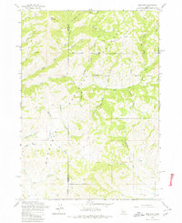
1963 Map of Deer Mountain
USGS Topo · Published 1980About this map
Deer Mountain stands as a prominent high point in this remote section of the Sawtooth National Forest along the border of Elmore and Camas counties. The landscape is defined by an intricate network of drainage systems, most notably Lime Creek and its many tributaries, which have carved a series of gulches and ridges through the terrain. The presence of Cold Spring Ridge and high-elevation features like Iron Mountain Creek and Stewart Creek illustrate the watershed's complexity before it flows toward more developed valleys. Access during this era was largely limited to a network of unimproved routes, including several segments of Jeep Trail, reflecting the area's primary use for timber management, wildlife preservation within the Game Preserve, and occasional industrial activity at the Gravel Pit.
Find a feature on this map
31 named features on this map. Tap any name to fly to it.
Don’t see what you’re looking for? This feature index may not catch every label — zoom into the map to look around manually.
Map Details
Editions of this 1963 Deer Mountain Map
Other maps of this area

1892 · Camas Prairie
USGS Topo · 1:125,000

1893 · Camas Prairie
USGS Topo · 1:125,000

1894 · Rocky Bar
USGS Topo · 1:125,000

1900 · Sawtooth
USGS Topo · 1:125,000

1955 · Hailey
USGS Topo · 1:250,000

1957 · Fairfield
USGS Topo · 1:62,500

1959 · Hailey
USGS Topo · 1:250,000

1962 · Hailey
USGS Topo · 1:250,000

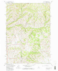
1963 · High Prairie
USGS Topo · 1:24,000

1963 · Deer Mountain
USGS Topo · 1:24,000