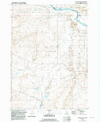
1992 Map of Castle Butte
USGS Topo · Published 1992About this map
The Snake River Birds of Prey Natural Area dominates this high-desert landscape in Owyhee County, where the Snake River carves through deep canyons and wide flats. Traces of human history and migration are visible along the northern reaches, most notably the Oregon Trail (South Alternate) as it parallels the river's path across Henderson Flats. The map documents a sparsely populated region defined by its water management and ranching legacy, featuring sites like Morgan Place, Rye Patch, and Foremans Reservoir.
Find a feature on this map
26 named features on this map. Tap any name to fly to it.
Don’t see what you’re looking for? This feature index may not catch every label — zoom into the map to look around manually.
Map Details
Editions of this 1992 Castle Butte Map
This is the sole edition of this map. No revisions or reprints were ever made.
Other maps of this area

1892 · Bisuka
USGS Topo · 1:125,000

1894 · Bisuka
USGS Topo · 1:125,000

1947 · Grand View
USGS Topo · 1:62,500

1947 · Jackass Butte
USGS Topo · 1:24,000

1947 · Wild Horse Butte
USGS Topo · 1:24,000

1947 · Vinson Wash
USGS Topo · 1:24,000

1948 · Castle Butte
USGS Topo · 1:24,000

1948 · Vinson Wash
USGS Topo · 1:24,000

1948 · Big Foot Butte
USGS Topo · 1:24,000

1948 · Wild Horse Butte
USGS Topo · 1:24,000