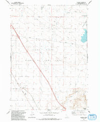
1992 Map of Reverse
USGS Topo · Published 1992About this map
The settlement of Reverse anchors this Elmore County landscape as it appeared in the early 1990s, situated north of the Snake River. The terrain is defined by the sweeping Birds of Prey Area, which covers the central portion of the quadrangle. Transportation corridors like Bennett Road and the remnant path of Old Highway 30 traverse the high desert plateaus, reflecting the region's historical transit patterns. Significant water features and geological landmarks dot the area, including Eureka Cave to the north and Commerford Springs near the southern boundary. To the northeast, the Hot Springs Creek Reservoir manages the flow of Hot Springs Creek. A series of pipelines and secondary roads like Rio Loop and Billy indicate the continued agricultural and industrial utility of this arid stretch of Idaho.
Find a feature on this map
17 named features on this map. Tap any name to fly to it.
Don’t see what you’re looking for? This feature index may not catch every label — zoom into the map to look around manually.
Map Details
Editions of this 1992 Reverse Map
This is the sole edition of this map. No revisions or reprints were ever made.
Other maps of this area

1892 · Mountain Home
USGS Topo · 1:125,000

1892 · Camas Prairie
USGS Topo · 1:125,000

1893 · Mountain Home
USGS Topo · 1:125,000

1893 · Camas Prairie
USGS Topo · 1:125,000

1947 · Indian Cove
USGS Topo · 1:24,000

1947 · Hammett
USGS Topo · 1:24,000

1947 · Sand Dunes
USGS Topo · 1:24,000

1948 · Sand Dunes
USGS Topo · 1:24,000

1948 · Hammett
USGS Topo · 1:24,000

1948 · Indian Cove
USGS Topo · 1:24,000