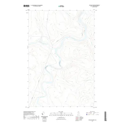
2021 Map of Big Black Rapids
USGS Topo · Published 2021About this map
The Saint John River carves a winding path through this corner of Aroostook County, serving as a primary geographical focus where it meets the Big Black River. This northern Maine landscape is defined by its complex network of waterways, including the turbulent Big Black Rapids and several small tributaries like Seminary Brook and Stewart Brook. Unlike more developed regions, the area is marked by a sparse road network, primarily consisting of corridors like Escourt Rd and Old River Rd that follow the natural contours of the river valleys. The topography suggests a timber-heavy economy, with logging access provided by Irving Rd amidst the varied elevations and wetlands of the North Woods. The map captures a moment of modern land management in a territory where the river remains the most dominant and enduring feature.
Find a feature on this map
10 named features on this map. Tap any name to fly to it.
Don’t see what you’re looking for? This feature index may not catch every label — zoom into the map to look around manually.
Map Details
Editions of this 2021 Big Black Rapids Map
This is the sole edition of this map. No revisions or reprints were ever made.
Other maps of this area

1954 · Presque Isle
USGS Topo · 1:250,000

1955 · Rocky Mountain
USGS Topo · 1:62,500

1955 · Little East Lake
USGS Topo · 1:62,500

1955 · Round Pond
USGS Topo · 1:62,500

1955 · Seven Islands
USGS Topo · 1:62,500

1958 · Presque Isle
USGS Topo · 1:250,000

1960 · Presque Isle
USGS Topo · 1:250,000

1962 · Edmundston
USGS Topo · 1:250,000

1976 · Seven Islands
USGS Topo · 1:24,000

1976 · East Lake SE
USGS Topo · 1:24,000