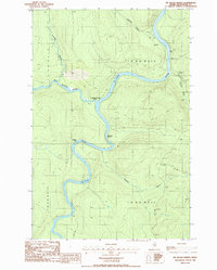
1986 Map of Big Black Rapids
USGS Topo · Published 1986About this map
The St John River snakes through the northern Maine wilderness in this mid-1980s record of Aroostook County, marking a remote boundary landscape where the Big Black River joins the main flow. This intersection is defined by the turbulent water of the Big Black Rapids and Basford Rtps, features that long dictated the movement of people and timber through these woods. The presence of the Immigration Service Camp near the riverbanks highlights the proximity of the international border, while several campsites scattered along the banks indicate the area's use by sportsmen and river travelers.
Find a feature on this map
16 named features on this map. Tap any name to fly to it.
Don’t see what you’re looking for? This feature index may not catch every label — zoom into the map to look around manually.
Map Details
Editions of this 1986 Big Black Rapids Map
This is the sole edition of this map. No revisions or reprints were ever made.
Other maps of this area

1954 · Presque Isle
USGS Topo · 1:250,000

1955 · Rocky Mountain
USGS Topo · 1:62,500

1955 · Little East Lake
USGS Topo · 1:62,500

1955 · Round Pond
USGS Topo · 1:62,500

1955 · Seven Islands
USGS Topo · 1:62,500

1958 · Presque Isle
USGS Topo · 1:250,000

1960 · Presque Isle
USGS Topo · 1:250,000

1962 · Edmundston
USGS Topo · 1:250,000

1976 · Seven Islands
USGS Topo · 1:24,000

1976 · East Lake SE
USGS Topo · 1:24,000