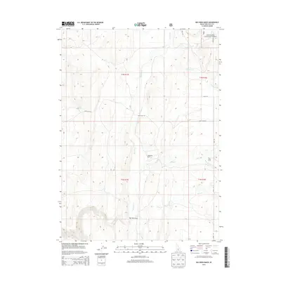
2013 Map of Big Creek Ranch
USGS Topo · Published 2013About this map
Shoshone Basin serves as the focal point for this 2013 topographic study, revealing a high-desert landscape defined by its vital water sources and ranching infrastructure. The Big Creek Ranch sits at the junction of Big Creek and Hannahs Fork, anchored by the remote transportation network of Basin Rd and the Basin Cutoff Rd. This corner of Twin Falls County transitions from the open draws of the West Basin Draw to the protected timberlands of the Sawtooth National Forest in the northeast. Small-scale hydrologic features such as Bull Spring, John Spring, and Hot Creek suggest the critical importance of localized water for livestock and settlement in an otherwise arid drainage system. The map documents the persistent layout of section lines and township boundaries, illustrating how early land surveys continue to dictate the modern rural character of the Idaho-Nevada borderlands.
Find a feature on this map
19 named features on this map. Tap any name to fly to it.
Don’t see what you’re looking for? This feature index may not catch every label — zoom into the map to look around manually.
Map Details
Editions of this 2013 Big Creek Ranch Map
This is the sole edition of this map. No revisions or reprints were ever made.
Other maps of this area

1955 · Twin Falls
USGS Topo · 1:250,000

1955 · Wells
USGS Topo · 1:250,000

1957 · Delaplain
USGS Topo · 1:62,500

1958 · Wells
USGS Topo · 1:250,000

1958 · Twin Falls
USGS Topo · 1:250,000

1961 · Wells
USGS Topo · 1:250,000

1961 · Gollaher Mountain
USGS Topo · 1:62,500

1977 · Timber Butte
USGS Topo · 1:24,000

1977 · Big Creek Ranch
USGS Topo · 1:24,000

1977 · Rogerson
USGS Topo · 1:24,000