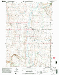
2001 Map of Big Creek Ranch
USGS Topo · Published 2006About this map
Shoshone Basin defines the topography of this high-desert landscape along the Idaho and Nevada border at the turn of the 21st century. The map illustrates a remote ranching and natural resource environment, anchored by the Big Creek Ranch and a network of water sources including Shoshone Creek, Langford Creek, and numerous isolated Springs. These water points were critical for the livestock operations that utilized the surrounding Sawtooth National Forest lands.
Find a feature on this map
22 named features on this map. Tap any name to fly to it.
Don’t see what you’re looking for? This feature index may not catch every label — zoom into the map to look around manually.
Map Details
Editions of this 2001 Big Creek Ranch Map
This is the sole edition of this map. No revisions or reprints were ever made.
Other maps of this area

1955 · Twin Falls
USGS Topo · 1:250,000

1955 · Wells
USGS Topo · 1:250,000

1957 · Delaplain
USGS Topo · 1:62,500

1958 · Wells
USGS Topo · 1:250,000

1958 · Twin Falls
USGS Topo · 1:250,000

1961 · Wells
USGS Topo · 1:250,000

1961 · Gollaher Mountain
USGS Topo · 1:62,500

1977 · Timber Butte
USGS Topo · 1:24,000

1977 · Big Creek Ranch
USGS Topo · 1:24,000

1977 · Rogerson
USGS Topo · 1:24,000