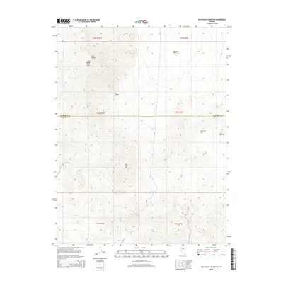
2014 Map of Big Kasock Mountain
USGS Topo · Published 2014About this map
Big Kasock Mtn serves as the central high point of this interior Nevada landscape, which straddles the boundary between Churchill and Mineral counties. The terrain is characterized by the rugged Sand Springs Range, marked notably by the Sand Springs Range Cairn at a prominent elevation. The map illustrates a high-desert environment where drainage and elevation dictate movement, seen clearly in the descent through Contact Canyon toward the broad expanse of Fairview Valley. Infrastructure is minimal and industrial in nature, centered on routes such as Scheelite Mine Rd and Poleline Rd, which hint at the region's mining and utility history. The eastern portion of the sheet transitions into the Sinkavata Hills and the secluded Little Bell Flat, showcasing a remote stretch of the Great Basin as it appeared in the early 21st century.
Find a feature on this map
17 named features on this map. Tap any name to fly to it.
Don’t see what you’re looking for? This feature index may not catch every label — zoom into the map to look around manually.
Map Details
Editions of this 2014 Big Kasock Mountain Map
This is the sole edition of this map. No revisions or reprints were ever made.
Other maps of this area

1908 · Carson Sink
USGS Topo · 1:250,000

1909 · Hawthorne
USGS Topo · 1:250,000

1910 · Carson Sink
USGS Topo · 1:250,000

1911 · Hawthorne
USGS Topo · 1:250,000

1915 · Hawthorne
USGS Topo · 1:250,000

1948 · Walker Lake
USGS Topo · 1:250,000

1957 · Walker Lake
USGS Topo · 1:250,000

1957 · Reno
USGS Topo · 1:250,000

1959 · Reno
USGS Topo · 1:250,000

1960 · Reno
USGS Topo · 1:250,000