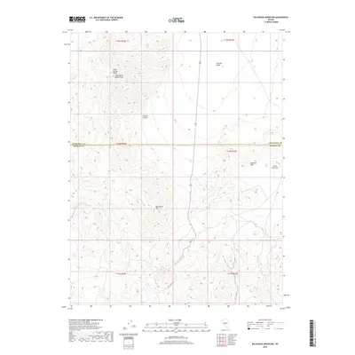
2018 Map of Big Kasock Mountain
USGS Topo · Published 2018About this map
Big Kasock Mtn serves as the focal point for this Great Basin landscape, where the northern Basin and Range topography transitions across the boundary of Churchill and Mineral counties. The high ridges of the Sand Springs Range dominate the western portion of the map, featuring the Sand Springs Range Cairn as a significant survey marker. To the east, the terrain descends into the broad expanse of Fairview Valley and the smaller Little Bell Flat, separated by the lower Sinkavata Hills. This 2018 survey reveals a desert landscape primarily defined by its natural landforms and remote access points like Ryan Canyon Rd and Contact Canyon, illustrating the sparse infrastructure common to these interior high-desert basins.
Find a feature on this map
16 named features on this map. Tap any name to fly to it.
Don’t see what you’re looking for? This feature index may not catch every label — zoom into the map to look around manually.
Map Details
Editions of this 2018 Big Kasock Mountain Map
This is the sole edition of this map. No revisions or reprints were ever made.
Other maps of this area

1908 · Carson Sink
USGS Topo · 1:250,000

1909 · Hawthorne
USGS Topo · 1:250,000

1910 · Carson Sink
USGS Topo · 1:250,000

1911 · Hawthorne
USGS Topo · 1:250,000

1915 · Hawthorne
USGS Topo · 1:250,000

1948 · Walker Lake
USGS Topo · 1:250,000

1957 · Walker Lake
USGS Topo · 1:250,000

1957 · Reno
USGS Topo · 1:250,000

1959 · Reno
USGS Topo · 1:250,000

1960 · Reno
USGS Topo · 1:250,000