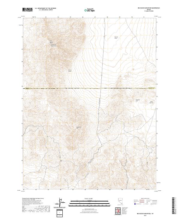
2021 Map of Big Kasock Mountain
USGS Topo · Published 2021About this map
Big Kasock Mtn rises as a central landmark in this high-desert landscape spanning the border of Churchill and Mineral counties. The topography is dominated by the complex ridges of the Sand Springs Range, where a Sand Springs Range Cairn marks a high point of historical surveying significance. This modern survey illustrates the persistent isolation of this Nevada interior, where the high-altitude terrain of the Sinkavata Hills and Contact Canyon drops away into the open expanse of Fairview Valley. Human infrastructure is sparse, characterized by the winding route of Ryan Canyon Rd and the broad, dry floor of Little Bell Flat, reflecting the region's long-standing character as a frontier of mining exploration and rangeland.
Find a feature on this map
15 named features on this map. Tap any name to fly to it.
Don’t see what you’re looking for? This feature index may not catch every label — zoom into the map to look around manually.
Map Details
Editions of this 2021 Big Kasock Mountain Map
This is the sole edition of this map. No revisions or reprints were ever made.
Other maps of this area

1908 · Carson Sink
USGS Topo · 1:250,000

1909 · Hawthorne
USGS Topo · 1:250,000

1910 · Carson Sink
USGS Topo · 1:250,000

1911 · Hawthorne
USGS Topo · 1:250,000

1915 · Hawthorne
USGS Topo · 1:250,000

1948 · Walker Lake
USGS Topo · 1:250,000

1957 · Walker Lake
USGS Topo · 1:250,000

1957 · Reno
USGS Topo · 1:250,000

1959 · Reno
USGS Topo · 1:250,000

1960 · Reno
USGS Topo · 1:250,000