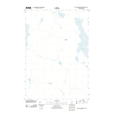
2011 Map of Big Spencer Mountain
USGS Topo · Published 2011About this map
Big Spencer Mountain dominates the southern landscape of this remote Maine township, a region defined by its complex network of waterways and glacial ponds. The eastern edge is anchored by the sprawling reaches of Ragged Lake, while the western border follows the shoreline of Lobster Lake. Between these major bodies, the interior is a mosaic of smaller basins including Cranberry Pond, Blood Pond, and the aptly named Grass Pond.
Find a feature on this map
15 named features on this map. Tap any name to fly to it.
Don’t see what you’re looking for? This feature index may not catch every label — zoom into the map to look around manually.
Map Details
Editions of this 2011 Big Spencer Mountain Map
This is the sole edition of this map. No revisions or reprints were ever made.
Other maps of this area

1920 · Moosehead Lake
USGS Topo · 1:62,500

1922 · Moosehead Lake
USGS Topo · 1:62,500

1930 · Moosehead Lake
USGS Topo · 1:62,500

1944 · Moosehead Lake
USGS Topo · 1:62,500

1952 · First Roach Pond
USGS Topo · 1:62,500

1954 · North East Carry
USGS Topo · 1:62,500

1954 · Grant Farm
USGS Topo · 1:62,500

1954 · Millinocket
USGS Topo · 1:250,000

1957 · Moosehead Lake
USGS Topo · 1:62,500

1958 · Millinocket
USGS Topo · 1:250,000
Featured Places
- TX R14 WELS, ME
- East Middlesex Canal Grant Township, ME
- Spencer Bay Township, ME
- T1 R13 WELS, ME
- T3 R13 WELS, ME