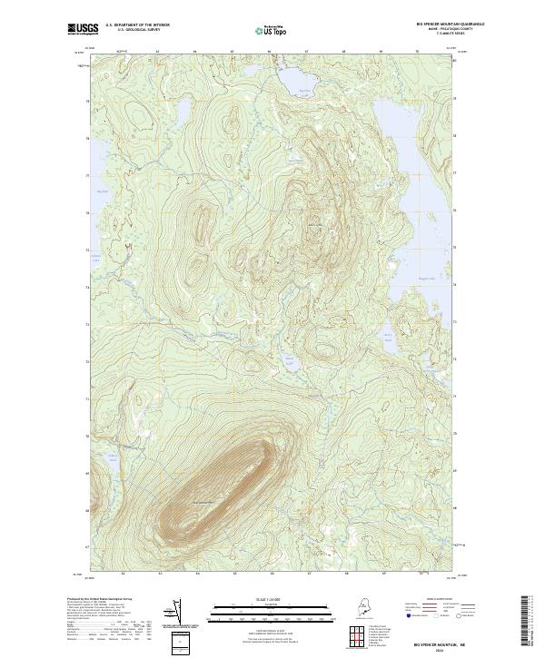
2024 Map of Big Spencer Mountain
USGS Topo · Published 2024About this map
Big Spencer Mtn dominates the southern landscape of this Piscataquis County quadrangle, rising above a network of remote waters and timberlands. The terrain is defined by its massive peaks and expansive glacial lakes, including the jagged eastern shoreline of Lobster Lake and its distinctive northern cove, Big Claw. This area of the Maine North Woods remains largely wild, with access provided by primitive routes such as Greenville Rd and Loop Rd. The drainage patterns are intricate, with Maxfield Brook and Kidney Brook winding through the lowlands between Black Cap Mtn and the numerous smaller water bodies like Blood Pond and Grass Pond. For those studying the geography of northern Maine, the map provides a clear record of the watershed and the topographic isolation of these prominent summits.
Find a feature on this map
16 named features on this map. Tap any name to fly to it.
Don’t see what you’re looking for? This feature index may not catch every label — zoom into the map to look around manually.
Map Details
Editions of this 2024 Big Spencer Mountain Map
This is the sole edition of this map. No revisions or reprints were ever made.
Other maps of this area

1920 · Moosehead Lake
USGS Topo · 1:62,500

1922 · Moosehead Lake
USGS Topo · 1:62,500

1930 · Moosehead Lake
USGS Topo · 1:62,500

1944 · Moosehead Lake
USGS Topo · 1:62,500

1952 · First Roach Pond
USGS Topo · 1:62,500

1954 · North East Carry
USGS Topo · 1:62,500

1954 · Grant Farm
USGS Topo · 1:62,500

1954 · Millinocket
USGS Topo · 1:250,000

1957 · Moosehead Lake
USGS Topo · 1:62,500

1958 · Millinocket
USGS Topo · 1:250,000
Featured Places
- TX R14 WELS, ME
- East Middlesex Canal Grant Township, ME
- Lobster Township, ME
- Spencer Bay Township, ME
- T1 R13 WELS, ME