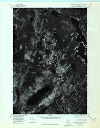
1977 Map of Big Spencer Mountain
USGS Topo · Published 1981About this map
Big Spencer Mountain anchors this 1977 orthophotoquad, which uses aerial photography to document the undeveloped wilderness of Piscataquis County. The imagery reveals the sharp topographical contrast between the high peaks and the water-heavy lowlands of the Maine North Woods. To the east, the irregular shoreline of Ragged Lake dominates the landscape, while the smaller Big Pine Pond and Cranberry Pond are visible in the northern reaches. The absence of roads and settlements underscores the timberland character of the era. Waterways like Maxfield Brook wind through the forest, connecting the larger bodies of water including a portion of Lobster Lake on the western edge. Notable elevations like Black Cap Mountain and Little Spencer Mountain stand out through the photographic shadows and textures of the forest canopy.
Find a feature on this map
8 named features on this map. Tap any name to fly to it.
Don’t see what you’re looking for? This feature index may not catch every label — zoom into the map to look around manually.
Map Details
Editions of this 1977 Big Spencer Mountain Map
This is the sole edition of this map. No revisions or reprints were ever made.
Other maps of this area

1920 · Moosehead Lake
USGS Topo · 1:62,500

1922 · Moosehead Lake
USGS Topo · 1:62,500

1930 · Moosehead Lake
USGS Topo · 1:62,500

1944 · Moosehead Lake
USGS Topo · 1:62,500

1952 · First Roach Pond
USGS Topo · 1:62,500

1954 · North East Carry
USGS Topo · 1:62,500

1954 · Grant Farm
USGS Topo · 1:62,500

1954 · Millinocket
USGS Topo · 1:250,000

1957 · Moosehead Lake
USGS Topo · 1:62,500

1958 · Millinocket
USGS Topo · 1:250,000
Featured Places
- Spencer Bay Township, ME
- East Middlesex Canal Grant Township, ME
- T3 R13 WELS, ME
- T2 R13 WELS, ME
- Lobster Township, ME