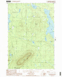
1988 Map of Big Spencer Mtn
USGS Topo · Published 1988About this map
Big Spencer Mtn dominates the southern landscape of this interior Maine wilderness, crowned by a Fire Lookout Tower that historically overlooked the surrounding timberlands and lakes. The terrain is defined by its water bodies and township boundaries, including the East Middlesex Canal Grant and several large tracts such as Lobster (T 3 R 14 W E L S). The map details a complex hydrologic network where Lobster Lake with its prominent Big Claw and the wide expanse of Ragged Lake frame a region of dense forest and smaller basins like Big Pine Pond and Cranberry Pond. This late-twentieth-century survey documents the working landscape of the North Woods, noting several locations of a Gravel Pit along the unimproved roads and trails that represent the primary human imprint on these remote townships.
Find a feature on this map
24 named features on this map. Tap any name to fly to it.
Don’t see what you’re looking for? This feature index may not catch every label — zoom into the map to look around manually.
Map Details
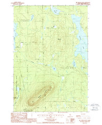
Editions of this 1988 Big Spencer Mtn Map
2 editions found
Other maps of this area

1920 · Moosehead Lake
USGS Topo · 1:62,500

1922 · Moosehead Lake
USGS Topo · 1:62,500

1930 · Moosehead Lake
USGS Topo · 1:62,500

1944 · Moosehead Lake
USGS Topo · 1:62,500

1952 · First Roach Pond
USGS Topo · 1:62,500

1954 · North East Carry
USGS Topo · 1:62,500

1954 · Grant Farm
USGS Topo · 1:62,500

1954 · Millinocket
USGS Topo · 1:250,000

1957 · Moosehead Lake
USGS Topo · 1:62,500

1958 · Millinocket
USGS Topo · 1:250,000
Featured Places
- Spencer Bay Township, ME
- East Middlesex Canal Grant Township, ME
- T3 R13 WELS, ME
- T2 R13 WELS, ME
- Lobster Township, ME