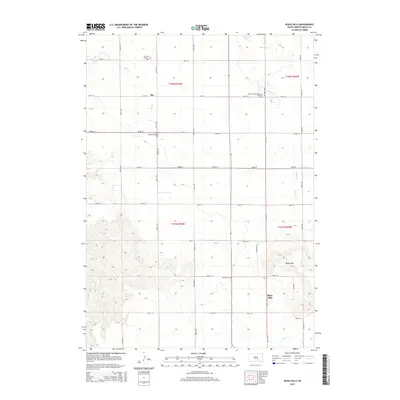
2015 Map of Bijou Hills
USGS Topo · Published 2015About this map
Bijou Hills rises as a prominent topographical landmark above the surrounding prairie of southern Brule County, serving as the namesake for both the upland and the small settlement located at the base of the heights. The area is characterized by a high concentration of rural burial grounds, reflecting the diverse heritage of early settlers through the German Lutheran Cem, Saint Vencels Bohemian National Cem, and Swedish Lutheran Cem. These sites, along with Union Cem, are scattered across a landscape defined by an orderly grid of local roads and sections, including t102n r70w and t101n r69w. Drainage for the township is provided by numerous seasonal and perennial waterways such as Elm Cr and Nelson Cr, while America Lake and the Panzour Dam reflect the management of water resources in this agricultural interior.
Find a feature on this map
30 named features on this map. Tap any name to fly to it.
Don’t see what you’re looking for? This feature index may not catch every label — zoom into the map to look around manually.
Map Details
Editions of this 2015 Bijou Hills Map
This is the sole edition of this map. No revisions or reprints were ever made.
Other maps of this area

1940 · Iona
USGS Topo · 1:62,500

1944 · Iona
USGS Topo · 1:62,500

1955 · Mitchell
USGS Topo · 1:250,000

1959 · Mitchell
USGS Topo · 1:250,000

1971 · Lucas NW
USGS Topo · 1:24,000

1971 · Academy
USGS Topo · 1:24,000

1971 · Dixon NE
USGS Topo · 1:24,000
1974 · Bond Bottom
USGS Topo · 1:24,000

1974 · Red Lake West
USGS Topo · 1:24,000

1979 · Bijou Hills NE
USGS Topo · 1:24,000