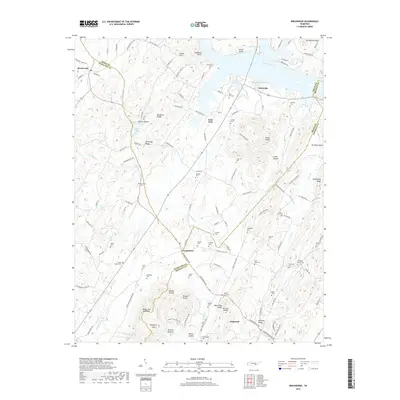
2019 Map of Birchwood
USGS Topo · Published 2019About this map
Georgetown serves as a central junction where Hamilton, Bradley, and Meigs counties converge, marking a landscape defined by its numerous family burial grounds and agricultural valleys. The Hiwassee River dominates the northern border, where water-access points like Fuller Slough and Hooper Slough break the riverbank near the settlement of Brittsville. To the west, the prominent ridge of White Oak Mountain rises above the valley floor, broken by the notable Taliaferro Gap. This area is particularly rich for genealogical research, documenting dozens of localized cemeteries such as Saint Elmo Cem, McClanahan Cem, and Smith Chapel Cem. The terrain is deeply textured with named hollows and ridges, including Fisher Hollow and McCulley Ridge, illustrating the traditional settlement patterns along the creek systems of Gunstocker Cr and Lick Cr.
Find a feature on this map
140 named features on this map. Tap any name to fly to it.
Don’t see what you’re looking for? This feature index may not catch every label — zoom into the map to look around manually.
Map Details
Editions of this 2019 Birchwood Map
This is the sole edition of this map. No revisions or reprints were ever made.
Other maps of this area

1886 · Cleveland
USGS Topo · 1:125,000

1888 · Chattanooga
USGS Topo · 1:125,000

1892 · Cleveland
USGS Topo · 1:125,000

1893 · Chattanooga
USGS Topo · 1:125,000

1895 · Cleveland
USGS Topo · 1:125,000

1901 · Cleveland
USGS Topo · 1:125,000

1935 · East Cleveland
USGS Topo · 1:24,000

1935 · Goodfield
USGS Topo · 1:24,000

1935 · Snow Hill
USGS Topo · 1:24,000

1935 · Charleston
USGS Topo · 1:24,000