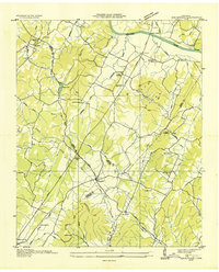
1935 Map of Birchwood
USGS Topo · Published 1935About this map
The Hiwassee River snakes across the northern reaches of this territory, where the Russell Bridge facilitates passage near the settlement of Brittsville. Surveyed in the mid-1930s, the landscape is defined by the convergence of Hamilton, Meigs, and Bradley counties. Small rural communities like Birchwood and Georgetown serve as central hubs, connected by the early alignments of State Highway No 58 and State Highway No 60. The map is particularly dense with educational and religious landmarks, including the Clint Hill Sch and the Mt Zion Ch, illustrating the social fabric of these ridge-and-valley settlements.
Find a feature on this map
45 named features on this map. Tap any name to fly to it.
Don’t see what you’re looking for? This feature index may not catch every label — zoom into the map to look around manually.
Map Details
Editions of this 1935 Birchwood Map
This is the sole edition of this map. No revisions or reprints were ever made.
Other maps of this area

1886 · Cleveland
USGS Topo · 1:125,000

1888 · Chattanooga
USGS Topo · 1:125,000

1892 · Cleveland
USGS Topo · 1:125,000

1893 · Chattanooga
USGS Topo · 1:125,000

1895 · Cleveland
USGS Topo · 1:125,000

1901 · Cleveland
USGS Topo · 1:125,000

1935 · East Cleveland
USGS Topo · 1:24,000

1935 · Goodfield
USGS Topo · 1:24,000

1935 · Snow Hill
USGS Topo · 1:24,000

1935 · Charleston
USGS Topo · 1:24,000