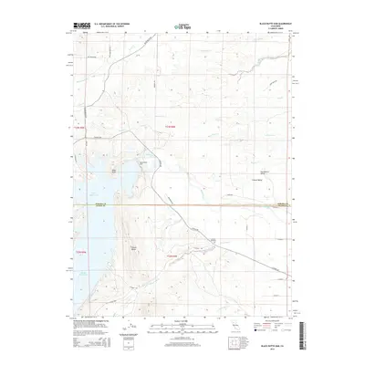
2015 Map of Black Butte Dam
USGS Topo · Published 2015About this map
Black Butte Dam dominates this landscape, holding back the waters of Stony Creek to form the expansive Black Butte Lake. Located along the border of Tehama Co and Glenn Co, the area transitions from the western edge of the Sacramento Valley into the rising terrain of the Orland Buttes. This 2015 survey provides a modern snapshot of the region's managed water systems and rural infrastructure, including the various county roads like Co Road 200 and Wackerman Rd that navigate the shoreline.
Find a feature on this map
43 named features on this map. Tap any name to fly to it.
Don’t see what you’re looking for? This feature index may not catch every label — zoom into the map to look around manually.
Map Details
Editions of this 2015 Black Butte Dam Map
This is the sole edition of this map. No revisions or reprints were ever made.
Other maps of this area

1904 · Vina
USGS Topo · 1:62,500

1904 · Walker Creek
USGS Topo · 1:31,680

1906 · Willows
USGS Topo · 1:62,500

1914 · Kirkwood
USGS Topo · 1:31,680

1914 · Orland
USGS Topo · 1:31,680

1919 · Fruto
USGS Topo · 1:62,500

1944 · Fruto
USGS Topo · 1:62,500

1944 · Flournoy
USGS Topo · 1:62,500
1949 · Kirkwood
USGS Topo · 1:24,000
1950 · Kirkwood
USGS Topo · 1:24,000