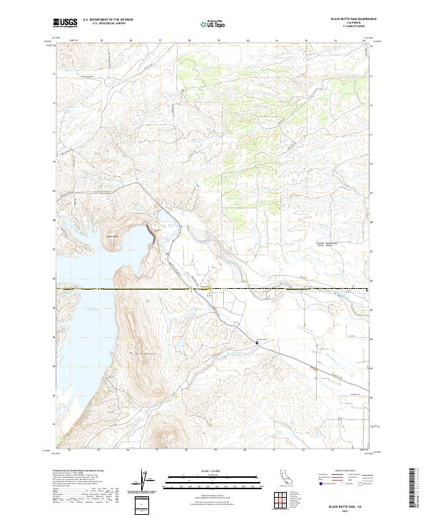
2021 Map of Black Butte Dam
USGS Topo · Published 2021About this map
Black Butte Lake and the prominent volcanic landmark of Black Butte dominate this northern California landscape where the Sacramento Valley meets the rising foothills. The reservoir, formed by the damming of Stony Creek, sits at the convergence of Tehama and Glenn counties, creating a complex shoreline that borders the rugged Orland Buttes. This 2021 survey reveals a territory defined by seasonal drainages such as Sehorn Cr, Brannin Creek, and Hambright Cr, which carve through the Central Valley terrain. Local history is anchored by the Graves Cem located north of Newville Rd. The transportation network is primarily composed of rural connectors like Black Butte Rd E and Long Hollow Rd, reflecting a landscape dedicated to water management and open grazing lands between the peaks and the valley floor.
Find a feature on this map
46 named features on this map. Tap any name to fly to it.
Don’t see what you’re looking for? This feature index may not catch every label — zoom into the map to look around manually.
Map Details
Editions of this 2021 Black Butte Dam Map
This is the sole edition of this map. No revisions or reprints were ever made.
Other maps of this area

1904 · Vina
USGS Topo · 1:62,500

1904 · Walker Creek
USGS Topo · 1:31,680

1906 · Willows
USGS Topo · 1:62,500

1914 · Kirkwood
USGS Topo · 1:31,680

1914 · Orland
USGS Topo · 1:31,680

1919 · Fruto
USGS Topo · 1:62,500

1944 · Fruto
USGS Topo · 1:62,500

1944 · Flournoy
USGS Topo · 1:62,500
1949 · Kirkwood
USGS Topo · 1:24,000
1950 · Kirkwood
USGS Topo · 1:24,000