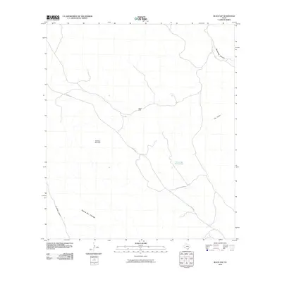
2010 Map of Black Gap
USGS Topo · Published 2010About this map
Black Gap serves as a central pass through the high desert of Brewster County, where the landscape is defined by the massive peaks of Sierrra Del Carmen and the prominent Stairway Mountain. This area of West Texas is characterized by its deep drainage systems and seasonal water sources, most notably Maravillas Creek as it winds through Maravillas Canyon. Human presence is marked by isolated infrastructure like FM 2627 HWY and the Black Gap W M Dru Rd, providing access to the remote backcountry. Strategic water points such as the Hole in the Ground Tank appear alongside significant geological features like Dog Canyon and Big Brushy Canyon, illustrating the challenging conditions of the Trans-Pecos region. The map highlights a territory where traditional ranching routes and modern highways intersect against a backdrop of steep elevation changes and desert basins.
Find a feature on this map
10 named features on this map. Tap any name to fly to it.
Don’t see what you’re looking for? This feature index may not catch every label — zoom into the map to look around manually.
Map Details
Editions of this 2010 Black Gap Map
This is the sole edition of this map. No revisions or reprints were ever made.
Other maps of this area

1903 · Chisos Mountains
USGS Topo · 1:125,000

1905 · Chisos Mountains
USGS Topo · 1:125,000

1917 · Bone Spring
USGS Topo · 1:62,500

1918 · Bone Spring
USGS Topo · 1:125,000

1918 · Bone Spring
USGS Topo · 1:62,500

1919 · Maravillas Canyon
USGS Topo · 1:62,500

1920 · Bone Spring
USGS Topo · 1:62,500

1930 · Stillwell Creek
USGS Topo · 1:62,500

1959 · Emory Peak
USGS Topo · 1:250,000

1965 · Emory Peak
USGS Topo · 1:250,000