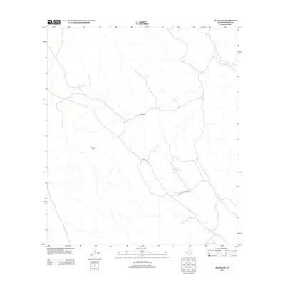
2013 Map of Black Gap
USGS Topo · Published 2013About this map
Black Gap serves as a central landmark in this portion of Brewster County, where the high desert terrain is defined by dramatic elevation changes and essential water catchments. The landscape is dominated by the massive profile of Stairway Mtn, a feature that overlooks the seasonal drainage of Maravillas Cr in the northern section of the survey. Human presence in this arid environment is tied closely to road networks and water security, with Ranch Road 2627 providing the primary transit corridor. Small-scale infrastructure for ranching and wildlife management is evident through named features like Dell Tank and the uniquely identified Hole in the Ground Tank. The presence of the Black Gad W M Dru Rd further illustrates the specialized local infrastructure used to navigate this corner of the Big Bend region.
Find a feature on this map
7 named features on this map. Tap any name to fly to it.
Don’t see what you’re looking for? This feature index may not catch every label — zoom into the map to look around manually.
Map Details
Editions of this 2013 Black Gap Map
This is the sole edition of this map. No revisions or reprints were ever made.
Other maps of this area

1903 · Chisos Mountains
USGS Topo · 1:125,000

1905 · Chisos Mountains
USGS Topo · 1:125,000

1917 · Bone Spring
USGS Topo · 1:62,500

1918 · Bone Spring
USGS Topo · 1:125,000

1918 · Bone Spring
USGS Topo · 1:62,500

1919 · Maravillas Canyon
USGS Topo · 1:62,500

1920 · Bone Spring
USGS Topo · 1:62,500

1930 · Stillwell Creek
USGS Topo · 1:62,500

1959 · Emory Peak
USGS Topo · 1:250,000

1965 · Emory Peak
USGS Topo · 1:250,000