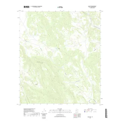
2019 Map of Black Gap
USGS Topo · Published 2019About this map
Sierra del Carmen and the surrounding high desert terrain dominate this part of Brewster County, where the landscape is defined by deep drainages and isolated water sources. The map reveals a remote network of ranch roads and specialized water catchments, such as Bee Cove Tank and Rockhouse Tank, which are essential for survival in this arid environment. Significant topographic features including Stairway Mtn and Sierra Larga create a dramatic backdrop for the winding Maravillas Canyon. This area, largely part of the Black Gap wildlife management zone, shows very little modern development, preserving the primitive routes like Ranch Rd 2627 and Stillwell Crossing Rd that follow the natural contours of the canyons. Geologic history is written in the sharp descents of Dog Canyon and Big Brushy Canyon, illustrating the erosive power of seasonal water moving toward the Rio Grande drainage system.
Find a feature on this map
15 named features on this map. Tap any name to fly to it.
Don’t see what you’re looking for? This feature index may not catch every label — zoom into the map to look around manually.
Map Details
Editions of this 2019 Black Gap Map
This is the sole edition of this map. No revisions or reprints were ever made.
Other maps of this area

1903 · Chisos Mountains
USGS Topo · 1:125,000

1905 · Chisos Mountains
USGS Topo · 1:125,000

1917 · Bone Spring
USGS Topo · 1:62,500

1918 · Bone Spring
USGS Topo · 1:125,000

1918 · Bone Spring
USGS Topo · 1:62,500

1919 · Maravillas Canyon
USGS Topo · 1:62,500

1920 · Bone Spring
USGS Topo · 1:62,500

1930 · Stillwell Creek
USGS Topo · 1:62,500

1959 · Emory Peak
USGS Topo · 1:250,000

1965 · Emory Peak
USGS Topo · 1:250,000