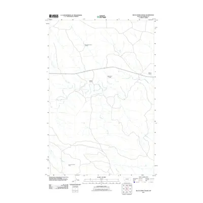
2011 Map of Black John Coulee
USGS Topo · Published 2011About this map
Big Dry Creek meanders through this section of Garfield County, defining a landscape of deep drainage basins and scattered water management infrastructure. The map illustrates a ranching-focused geography where named features like Black John Coulee and Russian Coulee converge toward the creek valley. Human presence is marked primarily by small-scale irrigation and stock water projects, specifically Big Bucks Number 10 Dam in the north and Harbaugh Number 1 Dam near the southern boundary. These dams, along with the winding course of Langs Fork, highlight the importance of water capture in this arid Montana environment. Transportation is anchored by the east-west corridor of Route 200, which provides the primary access point to the more remote coulees and creek beds that characterize this terrain.
Find a feature on this map
9 named features on this map. Tap any name to fly to it.
Don’t see what you’re looking for? This feature index may not catch every label — zoom into the map to look around manually.
Map Details
Editions of this 2011 Black John Coulee Map
This is the sole edition of this map. No revisions or reprints were ever made.
Other maps of this area

1954 · Jordan
USGS Topo · 1:250,000

1956 · Jordan
USGS Topo · 1:250,000

1958 · Jordan
USGS Topo · 1:250,000

1964 · Jordan
USGS Topo · 1:250,000

1964 · Jordan SE
USGS Topo · 1:24,000

1964 · Jordan NE
USGS Topo · 1:24,000

1964 · Ada Creek
USGS Topo · 1:24,000

1964 · Bateman Coulee
USGS Topo · 1:24,000

1964 · Black John Coulee
USGS Topo · 1:24,000

1964 · Bateman Coulee NE
USGS Topo · 1:24,000