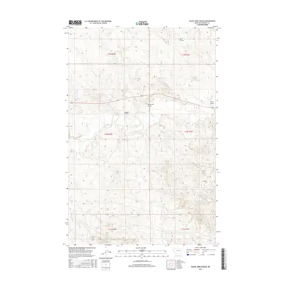
2017 Map of Black John Coulee
USGS Topo · Published 2017About this map
Big Dry Creek and its southern tributary, Langs Fork, define the drainage patterns across this Garfield County landscape. The terrain is characterized by a series of named coulees, including Black John Coulee and Russian Coulee, which highlight the complex erosion patterns typical of this part of Montana. These features provide a clear view of the local topography as it was managed under the Public Land Survey System, with township and range lines such as t18n r39e and t19n r40e providing the structural grid for land ownership and administration. The map illustrates how natural drainages like Nelson Coulee and Allen Coulee intersect with the primary watercourses, creating a detailed network of seasonal flow and relief that has historically dictated land use and livestock movement in this expansive ranching country.
Find a feature on this map
13 named features on this map. Tap any name to fly to it.
Don’t see what you’re looking for? This feature index may not catch every label — zoom into the map to look around manually.
Map Details
Editions of this 2017 Black John Coulee Map
This is the sole edition of this map. No revisions or reprints were ever made.
Other maps of this area

1954 · Jordan
USGS Topo · 1:250,000

1956 · Jordan
USGS Topo · 1:250,000

1958 · Jordan
USGS Topo · 1:250,000

1964 · Jordan
USGS Topo · 1:250,000

1964 · Jordan SE
USGS Topo · 1:24,000

1964 · Jordan NE
USGS Topo · 1:24,000

1964 · Ada Creek
USGS Topo · 1:24,000

1964 · Bateman Coulee
USGS Topo · 1:24,000

1964 · Black John Coulee
USGS Topo · 1:24,000

1964 · Bateman Coulee NE
USGS Topo · 1:24,000