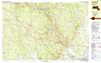
1987 Map of Blandford
USGS Topo · Published 1987About this map
Blandford and the steep terrain of the Berkshire foothills dominate this late-1980s landscape, where the Westfield River carves a deep valley through the center of the sheet. The river corridor serves as the primary artery for industry and transport, hosting the Conrail line and connecting the mill settlements of Crescent Mills, Russell, and Woronoco. Further west, the town of Blandford sits at a higher elevation, surrounded by numerous named hills like Sunset Hill and Dug Hill.
Find a feature on this map
134 named features on this map. Tap any name to fly to it.
Don’t see what you’re looking for? This feature index may not catch every label — zoom into the map to look around manually.
Map Details
Editions of this 1987 Blandford Map
This is the sole edition of this map. No revisions or reprints were ever made.
Other maps of this area

1885 · Northampton
USGS Topo · 1:62,500

1886 · Springfield
USGS Topo · 1:62,500

1886 · Chesterfield
USGS Topo · 1:62,500

1886 · Northampton
USGS Topo · 1:62,500

1886 · Becket
USGS Topo · 1:62,500

1887 · Granville
USGS Topo · 1:62,500

1888 · Becket
USGS Topo · 1:62,500

1888 · Sandisfield
USGS Topo · 1:62,500

1888 · Chesterfield
USGS Topo · 1:62,500

1889 · Springfield
USGS Topo · 1:62,500