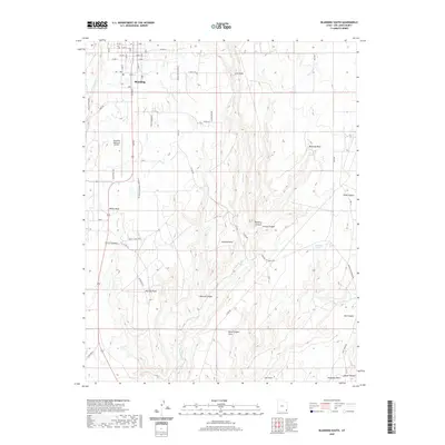
2020 Map of Blanding South
USGS Topo · Published 2020About this map
The settlement of Blanding sits at the northern edge of this high-desert plateau, where the grid of city streets transitions into a complex landscape of canyon systems and mesa points. To the south, the community of White Mesa is situated along the main thoroughfare of Main St, surrounded by the dramatic topography of Corral Canyon and Browns Canyon. This modern survey illustrates how infrastructure like the Blanding Municipal Airport and a network of county roads, such as Around the World Rd, navigate the deep drainages of Recapture Cr and Westwater Cr.
Find a feature on this map
56 named features on this map. Tap any name to fly to it.
Don’t see what you’re looking for? This feature index may not catch every label — zoom into the map to look around manually.
Map Details
Editions of this 2020 Blanding South Map
This is the sole edition of this map. No revisions or reprints were ever made.
Other maps of this area

1886 · Abajo
USGS Topo · 1:250,000

1892 · Abajo
USGS Topo · 1:250,000

1893 · Abajo
USGS Topo · 1:250,000

1935 · Elk Ridge
USGS Topo · 1:96,000

1940 · Elk Ridge
USGS Topo · 1:125,000

1955 · Verdure 3 SE
USGS Topo · 1:24,000

1955 · Verdure 3 NE
USGS Topo · 1:24,000

1956 · Cortez
USGS Topo · 1:250,000
1957 · Elk Ridge 4 NE
USGS Topo · 1:24,000

1957 · Elk Ridge 4 SE
USGS Topo · 1:24,000