
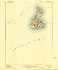
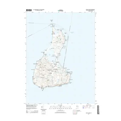
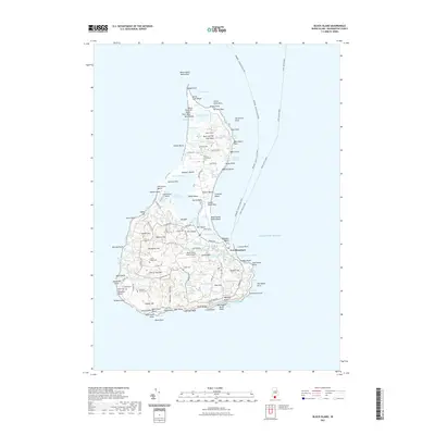
1894 Map of Block Island
USGS Topo · Published 1894About this map
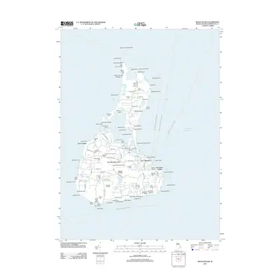
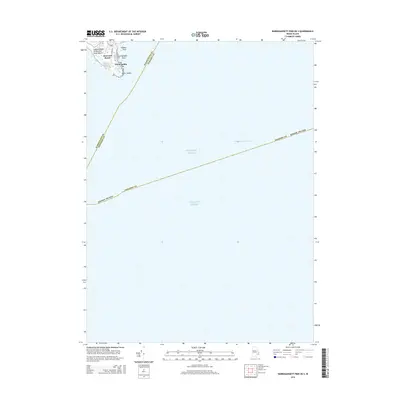
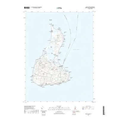
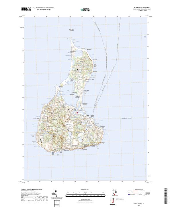
New Shoreham encompasses the entirety of this 1894 study, depicting an era of maritime navigation and coastal isolation before the advent of modern tourism. The interior is a network of small ponds, including Chagum Pond, Middle Pond, and Sands Pond, which punctuate the undulating landscape of the island's southern hills near Beacon Hill and Pilot Hill. Settlements are concentrated at New Shoreham Center, while the coastline reveals the critical infrastructure of late 19th-century seafaring. Light stations and life-saving facilities such as the Block Island N.L.H. at Sandy Point and the Block Island S.E.L.H. near S.E. Point provide essential safety for the heavy Atlantic trade routes. Along the western shore, Grace Point and Dickens Point define the rugged edge of the land, while the deeply recessed Great Salt Pond remains a prominent feature of the island's central geography.
Find a feature on this map
27 named features on this map. Tap any name to fly to it.
Don’t see what you’re looking for? This feature index may not catch every label — zoom into the map to look around manually.
Map Details
Editions of this 1894 Block Island Map
This is the sole edition of this map. No revisions or reprints were ever made.
Historical Maps of New Shoreham Through Time
43 maps found

1889 Block Island
Washington County, RI
1889 Charlestown
Washington County, RI
1894 Block Island
Washington County, RI
1899 Block Island
Washington County, RI

1919 Charlestown
Washington County, RI

1921 Charlestown
Washington County, RI

1942 Wickford
Washington County, RI

1943 Slocum
Washington County, RI

1944 Wickford
Washington County, RI

1950 Slocum
Washington County, RI
1955 Slocum
Washington County, RI
1957 Block Island
Washington County, RI
1957 Wickford
Washington County, RI

1984 Block Island
Washington County, RI
1995 Wickford
Washington County, RI

1996 Slocum
Washington County, RI

1998 Block Island
Washington County, RI

2001 Slocum
Washington County, RI
2012 Block Island
Washington County, RI
2012 Kingston OE S
Washington County, RI
2012 Narragansett Pier OE S
Washington County, RI
2012 Slocum
Washington County, RI
2012 Wickford
Washington County, RI
2015 Block Island
Washington County, RI
2015 Kingston OE S
Washington County, RI
2015 Narragansett Pier OE S
Washington County, RI
2015 Slocum
Washington County, RI
2015 Wickford
Washington County, RI
2018 Block Island
Washington County, RI
2018 Kingston OE S
Washington County, RI
2018 Narragansett Pier OE S
Washington County, RI
2018 Slocum
Washington County, RI
2018 Wickford
Washington County, RI
2021 Block Island
Washington County, RI
2021 Kingston OE S
Washington County, RI
2021 Narragansett Pier OE S
Washington County, RI
2021 Slocum
Washington County, RI
2021 Wickford
Washington County, RI
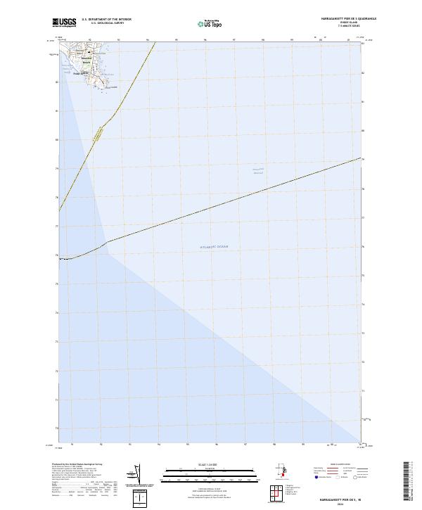
2024 Block Island
Washington County, RI
2024 Kingston OE S
Washington County, RI
2024 Narragansett Pier OE S
Washington County, RI

2024 Slocum
Washington County, RI
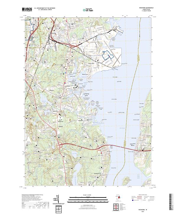
2024 Wickford
Washington County, RI