1904 Map of Montauk
USGS Topo · Published 1904About this map
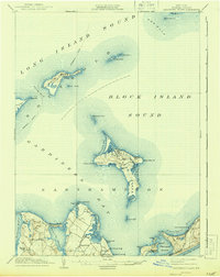
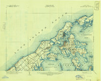
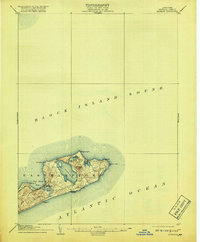
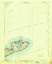
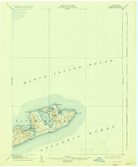
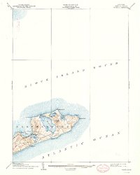
The tip of the South Fork in Easthampton is defined by a narrow landscape of glacial moraine and tidal waters, where the Long Island R. R. (Montauk Div.) terminates at the small settlement of Montauk. The coastal geography is dominated by large interior water bodies like Great Pond and Fort Pond, while the maritime safety infrastructure is anchored by the Montauk Point L.H. at the island's easternmost extremity. Life-saving stations at Ditch Plain L.S.S. and Hither Plain L.S.S. emphasize the historical dangers of this coast between the Block Island Sound and the Atlantic Ocean. Significant elevations such as Prospect Hill provide topographic contrast to the low-lying points like Shagwong Pt. and Culloden Pt., illustrating a landscape where the sea and rail are the primary drivers of human presence.
Find a feature on this map
19 named features on this map. Tap any name to fly to it.
Don’t see what you’re looking for? This feature index may not catch every label — zoom into the map to look around manually.
Map Details
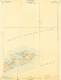
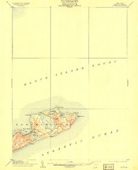
Editions of this 1904 Montauk Map
6 editions found
Historical Maps of East Hampton Through Time
10 maps found