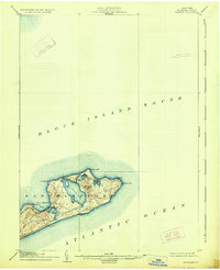
1904 Map of Montauk
USGS Topo · Published 1926About this map
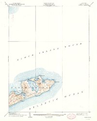
The easternmost tip of Long Island is defined by its maritime infrastructure and isolation at the opening of the twentieth century. The Montauk Point L.H. stands at the terminal point of the island, overlooking the meeting of Block Island Sound and the Atlantic Ocean. The arrival of the Long Island Montauk Div railroad transformed this landscape, connecting the small settlement of Montauk to the rest of New York. The map reveals a coast guarded by life-saving stations, including Ditch Plain L.S.S. and Wither Plain L.S.S., essential for navigation in these treacherous waters. Significant interior water bodies like Great Pond, Fort Pond, and Oyster Pond punctuate the terminal moraine topography, while Prospect Hill provides a high vantage over the surrounding headlands like Shagwong Pt. and Culloden Pt.
Find a feature on this map
19 named features on this map. Tap any name to fly to it.
Don’t see what you’re looking for? This feature index may not catch every label — zoom into the map to look around manually.
Map Details
Editions of this 1904 Montauk Map
6 editions found

Other maps of this area

1889 · Stonington
USGS Topo · 1:62,500

1889 · Charlestown
USGS Topo · 1:62,500

1889 · Block Island
USGS Topo · 1:62,500

1892 · New London
USGS Topo · 1:62,500

1893 · Stonington
USGS Topo · 1:62,500

1893 · New London
USGS Topo · 1:62,500

1894 · Block Island
USGS Topo · 1:62,500

1899 · Block Island
USGS Topo · 1:62,500

1903 · Gardiners Island
USGS Topo · 1:62,500

1904 · Easthampton
USGS Topo · 1:62,500