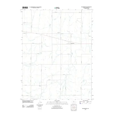
2012 Map of Bloomington
USGS Topo · Published 2012About this map
The S Fork Solomon River defines the central geography of this Osborne County region, carving a wide path through the prairie landscape just south of Bloomington. This 2012 survey illustrates a classic Kansas township grid, where section-line roads like S 180th Ave and W 70th Dr provide the primary framework for movement between scattered farmsteads. Local history is anchored by the Bloomington Cem and Mount Hope Cem, which serve as permanent records of the early families who settled this fertile river valley. Several seasonal tributaries, including Medicine Cr and Kill Cr, branch off the main river, highlighting the natural drainage patterns that have dictated agricultural use in the area for generations.
Find a feature on this map
26 named features on this map. Tap any name to fly to it.
Don’t see what you’re looking for? This feature index may not catch every label — zoom into the map to look around manually.
Map Details
Editions of this 2012 Bloomington Map
This is the sole edition of this map. No revisions or reprints were ever made.
Other maps of this area

1893 · Smith Center
USGS Topo · 1:125,000

1896 · Osborne
USGS Topo · 1:125,000

1953 · Bloomington
USGS Topo · 1:24,000

1953 · Osborne
USGS Topo · 1:24,000

1953 · Alton
USGS Topo · 1:24,000

1955 · Beloit
USGS Topo · 1:250,000

1959 · Beloit
USGS Topo · 1:250,000

1961 · Portis
USGS Topo · 1:24,000

1961 · Harlan
USGS Topo · 1:24,000

1961 · Gaylord SW
USGS Topo · 1:24,000