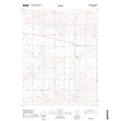
2018 Map of Bloomington
USGS Topo · Published 2018About this map
The S Fork Solomon River defines the east-west drainage of this Osborne County landscape, carving through a region defined by its orthogonal section-line roads and rolling agricultural uplands. The settlement of Bloomington sits along the southern bank of the river, serving as a localized hub for the surrounding farmsteads. Cultural markers for genealogists and local historians are well-preserved, including the Bloomington Cem north of the village and Mount Hope Cem to the southwest near the junction of Co Rd 388 and S 190th Ave. Significant tributaries like Medicine Cr and Kill Cr further detail the local hydrology, illustrating how these waterways dictated the early road network and placement of rural cemeteries within the township boundaries.
Find a feature on this map
33 named features on this map. Tap any name to fly to it.
Don’t see what you’re looking for? This feature index may not catch every label — zoom into the map to look around manually.
Map Details
Editions of this 2018 Bloomington Map
This is the sole edition of this map. No revisions or reprints were ever made.
Other maps of this area

1893 · Smith Center
USGS Topo · 1:125,000

1896 · Osborne
USGS Topo · 1:125,000

1953 · Bloomington
USGS Topo · 1:24,000

1953 · Osborne
USGS Topo · 1:24,000

1953 · Alton
USGS Topo · 1:24,000

1955 · Beloit
USGS Topo · 1:250,000

1959 · Beloit
USGS Topo · 1:250,000

1961 · Portis
USGS Topo · 1:24,000

1961 · Harlan
USGS Topo · 1:24,000

1961 · Gaylord SW
USGS Topo · 1:24,000