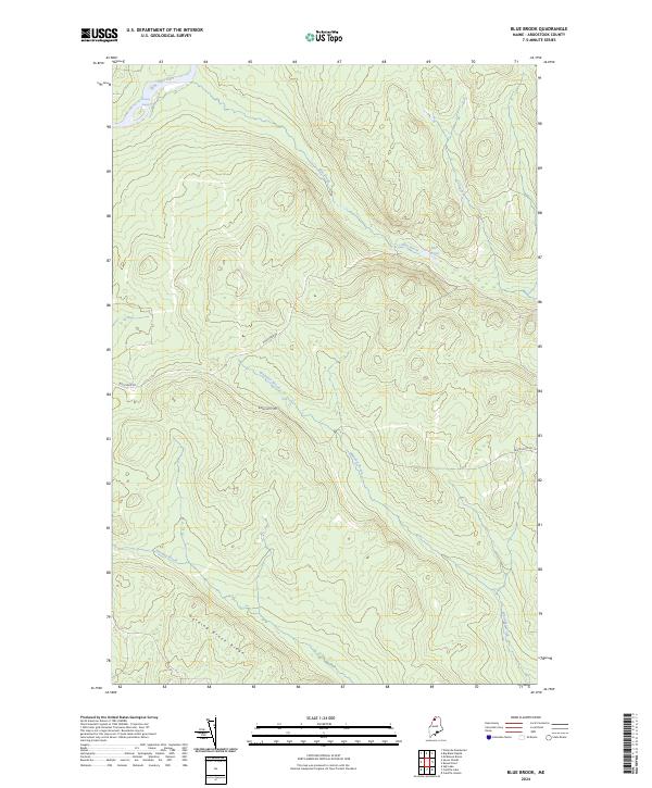
2024 Map of Blue Brook
USGS Topo · Published 2024About this map
The Saint John River defines the northwestern corner of this territory, where the Priestly Rapids churn through the waterway. The interior of the landscape is dominated by a complex network of tributaries, including Blue Brook and Whitaker Brook, which drain the elevated terrain of Harding Brook Ridge. This area in Aroostook County is characterized by its isolation and lack of dense settlement, with only primitive transit routes like Boulevard Rd and Blanchette Rd providing access through the forest. Small, still water bodies such as Blue Pond and Johnson Brook are found throughout the drainage basins, illustrating the saturated, high-elevation woodland characteristic of this northern Maine region.
Find a feature on this map
10 named features on this map. Tap any name to fly to it.
Don’t see what you’re looking for? This feature index may not catch every label — zoom into the map to look around manually.
Map Details
Editions of this 2024 Blue Brook Map
This is the sole edition of this map. No revisions or reprints were ever made.
Other maps of this area

1932 · Umsaskis Lake
USGS Topo · 1:48,000

1935 · Umsaskis Lake
USGS Topo · 1:62,500

1954 · Presque Isle
USGS Topo · 1:250,000

1955 · Round Pond
USGS Topo · 1:62,500

1955 · Clayton Lake
USGS Topo · 1:62,500

1955 · Seven Islands
USGS Topo · 1:62,500

1958 · Presque Isle
USGS Topo · 1:250,000

1960 · Presque Isle
USGS Topo · 1:250,000

1976 · Seven Islands
USGS Topo · 1:24,000
1976 · Ninemile Deadwater
USGS Topo · 1:24,000