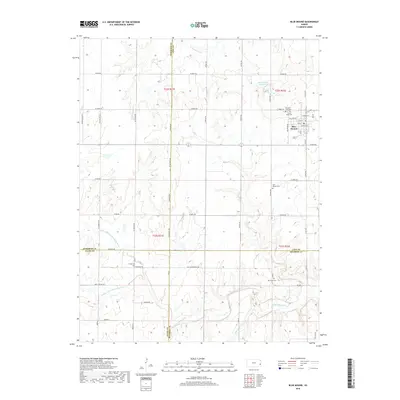
2018 Map of Blue Mound
USGS Topo · Published 2018About this map
Blue Mound serves as the primary hub of this eastern Kansas landscape, situated at the junction of several county lines where Linn, Anderson, Allen, and Bourbon counties meet. The township is characterized by a high density of rural cemeteries, including Pleasant View Cem, Sunny Slope Cem, and Blue Mound Cem, which provide significant points of interest for genealogical research. The drainage patterns are a defining geographic element, as the headwaters of the Little Osage River converge here. The map clearly delineates the N Fork Little Osage River, Middle Fork Little Osage River, and the S Fork Sugar Cr, illustrating how these waterways have historically shaped the agricultural boundaries and road placements of the region.
Find a feature on this map
60 named features on this map. Tap any name to fly to it.
Don’t see what you’re looking for? This feature index may not catch every label — zoom into the map to look around manually.
Map Details
Editions of this 2018 Blue Mound Map
This is the sole edition of this map. No revisions or reprints were ever made.
Other maps of this area

1884 · Fort Scott
USGS Topo · 1:125,000

1885 · Garnett
USGS Topo · 1:125,000

1886 · Iola
USGS Topo · 1:125,000

1886 · Fort Scott
USGS Topo · 1:125,000

1887 · Mound City
USGS Topo · 1:125,000

1893 · Fort Scott
USGS Topo · 1:125,000

1893 · Iola
USGS Topo · 1:125,000

1893 · Mound City
USGS Topo · 1:125,000

1894 · Garnett
USGS Topo · 1:125,000

1904 · Iola
USGS Topo · 1:125,000