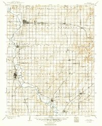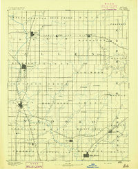
1893 Map of Iola
USGS Topo · Published 1893About this map
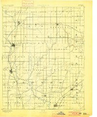
Neosho River provides the central geographical axis for this late nineteenth-century portrait of Allen and Neosho counties. The landscape is defined by the convergence of major rail lines, including the St Louis and San Francisco Railroad and the Missouri Pacific Railroad, which fueled the growth of vital shipping hubs like Iola and Humboldt. This survey records a dense network of early prairie settlements, many established shortly after the Civil War. While the larger towns developed around the rail junctions, smaller communities like Savonburgh, Warnersburgh, and Osage Mission served the surrounding agricultural townships. The map documents the intricate drainage of the region, tracing numerous tributaries such as Big Creek and Elm Creek as they meander through the township grids of Cottage Grove and Marmaton. It offers a clear view of the territorial organization before later industrial shifts altered the local economic landscape.
Find a feature on this map
63 named features on this map. Tap any name to fly to it.
Don’t see what you’re looking for? This feature index may not catch every label — zoom into the map to look around manually.
Map Details
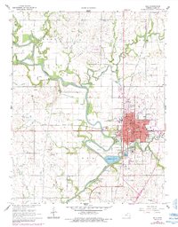
Editions of this 1893 Iola Map
2 editions found
Historical Maps of Chanute Through Time
9 maps found