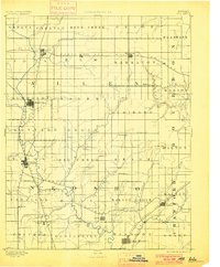
1893 Map of Iola
USGS Topo · Published 1900About this map
The Neosho River meanders through Southeast Kansas in this late nineteenth-century reconnaissance, defining a landscape of nascent rail hubs and agrarian townships. Surveyed in 1884, the map reveals a critical period of settlement where established centers like Iola and Humboldt grew alongside the expanding reach of the Missouri Kansas and Texas Railroad and the Southern Kansas Railroad. The grid-like division of townships, from Cottage Grove to Elm, reflects the systematic development of the frontier during this era. Numerous smaller settlements, such as Savonburgh, Laharpe, and Osage Mission, are documented at a time when they served as vital local trading posts for nearby farmsteads. The intricate drainage network, including Big Walnut Creek and Elm Creek, illustrates the natural geography that dictated early site selection for towns like Chanute and Erie.
Find a feature on this map
69 named features on this map. Tap any name to fly to it.
Don’t see what you’re looking for? This feature index may not catch every label — zoom into the map to look around manually.
Map Details
Editions of this 1893 Iola Map
2 editions found

Other maps of this area

1884 · Fort Scott
USGS Topo · 1:125,000

1885 · Burlington
USGS Topo · 1:125,000

1885 · Garnett
USGS Topo · 1:125,000

1886 · Fredonia
USGS Topo · 1:125,000

1886 · Joplin
USGS Topo · 1:125,000

1886 · Iola
USGS Topo · 1:125,000

1886 · Independence
USGS Topo · 1:125,000

1886 · Fort Scott
USGS Topo · 1:125,000

1886 · Parsons
USGS Topo · 1:125,000

1887 · Mound City
USGS Topo · 1:125,000