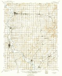
1904 Map of Iola
USGS Topo · Published 1949About this map
Neosho River meanders across this southeast Kansas landscape, serving as a primary geographic anchor for major rail-driven settlements at the dawn of the 20th century. The intricate rail infrastructure of the era is prominently displayed, showing the Santa Fe R. R. and the Missouri Pacific R. R. as they intersect at critical transit points like Iola and Chanute. These junctions fostered rapid growth in smaller satellite communities such as Gas and La Harpe, while established river towns like Humboldt maintained their importance through water and rail connectivity.
Find a feature on this map
66 named features on this map. Tap any name to fly to it.
Don’t see what you’re looking for? This feature index may not catch every label — zoom into the map to look around manually.
Map Details
Editions of this 1904 Iola Map
4 editions found

Other maps of this area

1884 · Fort Scott
USGS Topo · 1:125,000

1885 · Burlington
USGS Topo · 1:125,000

1885 · Garnett
USGS Topo · 1:125,000

1886 · Fredonia
USGS Topo · 1:125,000

1886 · Joplin
USGS Topo · 1:125,000

1886 · Iola
USGS Topo · 1:125,000

1886 · Independence
USGS Topo · 1:125,000

1886 · Fort Scott
USGS Topo · 1:125,000

1886 · Parsons
USGS Topo · 1:125,000

1887 · Mound City
USGS Topo · 1:125,000