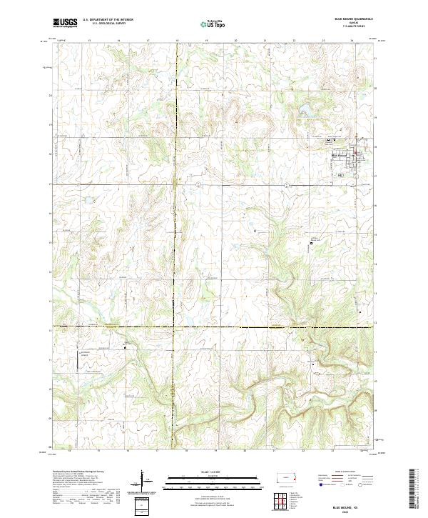
2022 Map of Blue Mound
USGS Topo · Published 2022About this map
Blue Mound sits at the nexus of a complex drainage system where the S-Fork Sugar Cr flows north and the various branches of the Little Osage River carve through the southern landscape. The settlement itself is anchored by a traditional grid including Main St and Kansas Ave, reflecting a typical prairie community layout. Just north of the town center, the Blue Mound Reservoir and Sunny Slope Cem mark the transition from the residential core to the surrounding agricultural landscape.
Find a feature on this map
44 named features on this map. Tap any name to fly to it.
Don’t see what you’re looking for? This feature index may not catch every label — zoom into the map to look around manually.
Map Details
Editions of this 2022 Blue Mound Map
This is the sole edition of this map. No revisions or reprints were ever made.
Other maps of this area

1884 · Fort Scott
USGS Topo · 1:125,000

1885 · Garnett
USGS Topo · 1:125,000

1886 · Iola
USGS Topo · 1:125,000

1886 · Fort Scott
USGS Topo · 1:125,000

1887 · Mound City
USGS Topo · 1:125,000

1893 · Fort Scott
USGS Topo · 1:125,000

1893 · Iola
USGS Topo · 1:125,000

1893 · Mound City
USGS Topo · 1:125,000

1894 · Garnett
USGS Topo · 1:125,000

1904 · Iola
USGS Topo · 1:125,000