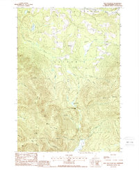
1988 Map of Blue Mountain
USGS Topo · Published 1988About this map
Colebrook, Columbia, and Stratford converge in this high-elevation corner of Coos County, where the landscape is defined by steep ridges and narrow mountain passes. The small settlement of Bungy sits in the northeast near the Mohawk River, while the rest of the terrain is a series of named summits and notches. Notable peaks like Blue Mountain and Gore Mountain are separated by deep gaps such as Cleveland Notch and Gore Notch, which dictate the flow of the region's many waterways. The drainage pattern is complex, with Simms Stream and its various branches, including the West Branch, carving through the timbered slopes. Large wetland features like Cranberry Bog Pond and Nash Bog Pond occupy the low basins between the massifs, reflecting the glacially-carved character of this New Hampshire wilderness. The map provides a detailed view of these natural barriers and the few forest roads that navigate the passes.
Find a feature on this map
40 named features on this map. Tap any name to fly to it.
Don’t see what you’re looking for? This feature index may not catch every label — zoom into the map to look around manually.
Map Details
Editions of this 1988 Blue Mountain Map
This is the sole edition of this map. No revisions or reprints were ever made.
Other maps of this area

1920 · Guildhall
USGS Topo · 1:62,500

1929 · Averill
USGS Topo · 1:62,500

1930 · Percy
USGS Topo · 1:62,500

1930 · Dixville
USGS Topo · 1:62,500

1931 · Guildhall
USGS Topo · 1:48,000

1933 · Guildhall
USGS Topo · 1:48,000

1933 · Dixville
USGS Topo · 1:62,500

1934 · Percy
USGS Topo · 1:62,500

1934 · Dixville
USGS Topo · 1:62,500

1937 · Guildhall
USGS Topo · 1:62,500