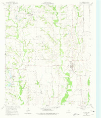
1960 Map of Blue Ridge
USGS Topo · Published 1975About this map
Blue Ridge stands as the primary hub in this northeast Texas landscape, situated at the intersection of a developing road network during the 1960s. The region is defined by the drainage of Pilot Grove Creek and Sister Grove Creek, which provide the topographical structure for several small agrarian settlements. Notable for genealogists are the rural burial sites and places of worship that anchored these communities, including Westminster Cemetery and the Story Point Church near Chambliss.
Find a feature on this map
27 named features on this map. Tap any name to fly to it.
Don’t see what you’re looking for? This feature index may not catch every label — zoom into the map to look around manually.
Map Details
Editions of this 1960 Blue Ridge Map
2 editions found
Other maps of this area

1929 · McKinney
USGS Topo · 1:62,500

1930 · Farmersville
USGS Topo · 1:62,500

1954 · Sherman
USGS Topo · 1:250,000

1958 · Sherman
USGS Topo · 1:250,000

1960 · McKinney East
USGS Topo · 1:24,000

1960 · Blue Ridge
USGS Topo · 1:24,000

1960 · Pike
USGS Topo · 1:24,000

1960 · Culleoka
USGS Topo · 1:24,000

1961 · Van Alstyne
USGS Topo · 1:24,000
1961 · Anna
USGS Topo · 1:24,000