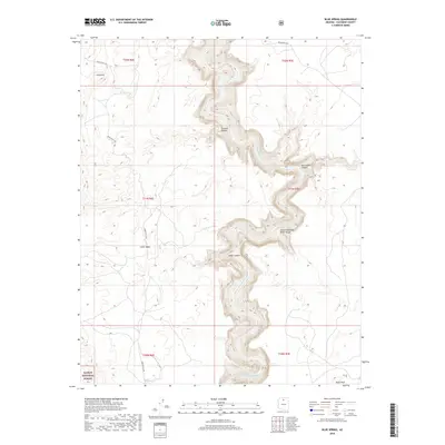
2018 Map of Blue Spring
USGS Topo · Published 2018About this map
The Little Colorado River carves a dramatic path through the high desert of Coconino County, creating the deep Little Colorado River Gorge that dominates this landscape. This 2018 survey documents a region defined by extreme topographic relief, where the river winds through steep-walled canyons including Straight Canyon, Cedar Canyon, and Waterhole Canyon. The presence of Blue Spring along the riverbed indicates a vital water source in this arid environment, while local landmarks like Gold Hill and Black Rock stand as prominent navigational markers.
Find a feature on this map
18 named features on this map. Tap any name to fly to it.
Don’t see what you’re looking for? This feature index may not catch every label — zoom into the map to look around manually.
Map Details
Editions of this 2018 Blue Spring Map
This is the sole edition of this map. No revisions or reprints were ever made.
Other maps of this area

1886 · San Francisco Mtns
USGS Topo · 1:250,000

1886 · Echo Cliffs
USGS Topo · 1:250,000

1891 · San Francisco Mtns
USGS Topo · 1:250,000

1891 · Echo Cliffs
USGS Topo · 1:250,000

1894 · San Francisco Mtns
USGS Topo · 1:250,000

1899 · San Francisco Mtns
USGS Topo · 1:250,000

1907 · Vishnu
USGS Topo · 1:48,000

1947 · Flagstaff
USGS Topo · 1:250,000

1954 · Flagstaff
USGS Topo · 1:250,000

1955 · Coconino Pt NE
USGS Topo · 1:24,000